
- Joined
- Oct 16, 2007
- Messages
- 2,611
- Reaction score
- 717
- Points
- 113
- Age
- 69
- Location
- Cape May, NJ
- Model
- Islander
Garmin has the upgrades on sale for Bluechart g3 to the new Garmin Navionics+ and Vision+ charts.
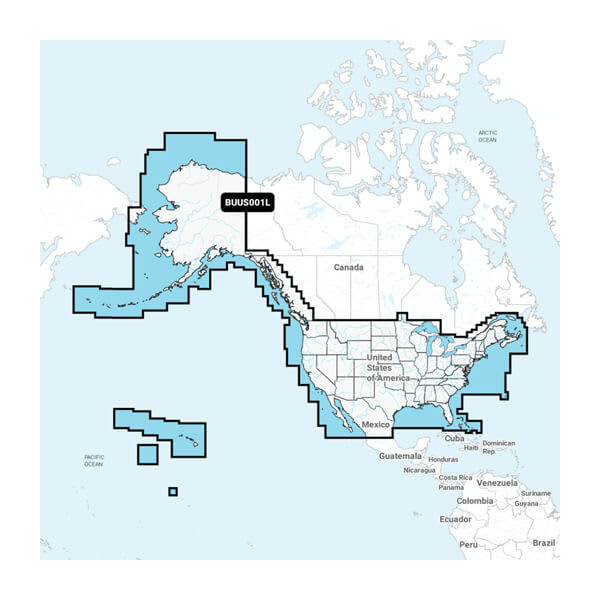
Built-in U.S. & Coastal Canada Built-in Chart Updates Garmin Navionics+™ | BUS001L. $149.99 >>> $99.99 ---- check your unit to see if you can replace basemaps.
U.S. & Coastal Canada - Lakes, Rivers and Coastal Marine Charts Garmin Navionics+™ | NSUS001L. $199.99 >>> $149.99
U.S. East - Lakes, Rivers and Coastal Marine Charts Garmin Navionics Vision+™ | NVUS007 $249.99 >>> $149.99
U.S. South - Lakes, Rivers and Coastal Marine Charts Garmin Navionics Vision+™ | NVUS006R $249.99 >>> $149.99
 www.garmin.com
Built-in U.S. & Coastal Canada Built-in Chart Updates Garmin Navionics+™ | BUS001L. $149.99 >>> $99.99 ---- check your unit to see if you can replace basemaps.
U.S. & Coastal Canada - Lakes, Rivers and Coastal Marine Charts Garmin Navionics+™ | NSUS001L. $199.99 >>> $149.99
U.S. East - Lakes, Rivers and Coastal Marine Charts Garmin Navionics Vision+™ | NVUS007 $249.99 >>> $149.99
U.S. South - Lakes, Rivers and Coastal Marine Charts Garmin Navionics Vision+™ | NVUS006R $249.99 >>> $149.99
Garmin U.S. & Coastal Canada Built-in Chart Updates
U.S. & Coastal Canada Built-in Chart Updates by Garmin.
www.garmin.com


