- Joined
- Oct 12, 2017
- Messages
- 4,874
- Reaction score
- 1,748
- Points
- 113
- Location
- Manasquan Inlet NJ
- Website
- www.youtube.com
- Model
- Express 265
https://www.ncei.noaa.gov/maps/bathymetry/
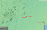
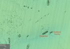
I stumbled across this site and found some high resolution color bottom contours for my area (Ocean/Monmouth county NJ). I've been finding lots of "gold" on this map and punching it into my Garmin. I have the Garmin on my lap at the computer. The mouse on the viewer gives you lat/lon in decimal degrees so its best to set the garmin that way. Love the touch screen for entering and naming waypoints!
Funny thing, the viewer displays the lat/lon backwards as lon/lat...stupid. Also, if you click the mouse it marks an X. Be careful because the lat/lon readout is from the mouse position not the X!
There are some high res areas for DelMarVa and Florida reefs from Boca to Miami and Key West.
Its a complicated mess of a site but I found you can weed out the crap using only the checks in the circled settings.


