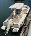
If you're not locked in to you're starting point, there are many professional boat haulers who will take you to more protected waters to begin such an adventure. And they will do it on your schedule.
From there, just plot out marinas with nearby hotels. Or, we have Uber and Lyft now.
I did the Great Loop this way, most of it while still employed, so could only take two weeks at a time. I started out with our 208 Adventure but most of it was on our Journey 258. We saved Lakes Michigan and Huron and a venture into Canada for retirement and a Sailfish 282. On all of these trips there were a few stops with no hotel options, but you can carry enough food and water to cover those nights, even if it means non-refridgerated food for dinner.
Like every other adventure, be smart and be prepared.
Very many marinas with nearby hotels in Long Island Sound if you don't mind starting there. Same is true for Hudson River up to Troy, NY, if you want to take the Erie Canal into the Great Lakes. You will have 'weather days' waiting for calm water on the Great Lakes, even in Summer. But, you also can find reasonably spaced marinas with hotels within easy walking distance, if not part of the marina, for the entire length of the Great Lakes.
If you choose to go south from Long Island Sound, you'll have to contend with New York Harbor. It was sloppy for me on a calm wind day just from ship and tug and ferry traffic. Also, learn the traffic patterns of the harbor on a real chart. Otherwise, the myriad of red and green markers might just look like a mess to you. Did to me at first.
You might have to wait for a favorable day to make the 35-mile(?) outside run down the NJ coast to Manasquan Inlet. There are very many marinas with walkable hotels around New York Harbor.
Plan to wait a few days in Cape May for favorable, early morning wind and tide to make the run up Delaware Bay. But once you make to 50-mile(?) run up Delaware Bay, you're into the C&D Canal and on your way into Chesapeake Bay. Both of which have many marinas with hotels.
At the bottom of Chesapeake Bay is Norfolk and Mile Point 0.0 of the Atlantic Intracoastal Waterway and you're on your way to the Florida Keys!
I'll make one uncommon recommendation: A VHF radio with AIS that talks to your chart plotter. Even better if you can afford a black box AIS that also transmits.
If you make the kind of trip I think you're contemplating, you will almost certainly encounter mega-yachts, tugs with barges, Dredges seemingly in the middle of the channel, freighters, etc. When I did the loop that made for some hairy situations when I couldn't get the big boat on the radio to arrange passing.
Now, with AIS, I believe I get an answer every time. And the tugs pushing barges appreciate a recreational boater asking on which side to overtake. I have been told that a tug was about to position himself for a turn, so would I just sit back for a few and he'll let me know when it's safe to pass. Or to pass on one side because there are unmarked snags on the other side.
We make side trips off the Great Loop now, things like the Tennessee River, the North Channel in Canada, etc. AIS makes such a difference in narrow channels.
There are apps that will tell you of all the marinas and their services within a given range. Useful to have on large bodies of water like Long Island Sound or the Great Lakes. I've never seen weather turn faster anywhere than the Great Lakes. I was always thinking 'where is my nearest duck in marina if I need it?'. No marina will turn you away if you're hiding out from an approaching thunderstorm. And with your size boat, it will be very easy to find slip space just about anywhere you go.
We recently went down the Tennessee River. It was a busy time due to all of the big boats coing down from the Chicago area. I was surprised at how many times I called ahead to a marina and heard, "we can always find space for a 28' boat". The average boat size has gotten so much larger than when I started boating a long time ago!
Those same boat haulers who started you off can pick you up at a specific marina or boat ramp given a week or two's notice. Actually, any of the really big marinas with ramps will likely be able to give you a few names.
I've gone on way long enough. If you have any questions for me, feel free to ask.
Rob