Boat Trip: Clarksville, TN to Huntsville, AL. With Pictures and maybe a video or two.

wahoo33417

GreatGrady Captain
Joined
Feb 28, 2005
Messages
1,255
Reaction score
251
Points
83
Location
West Palm Beach, FL
Model
Sailfish
We are on a trip from Clarksville, about an hour outside of Nashville, planned to end at Huntsville, AL. The great part is that my wife will join me for the first week. We'll take the Cumberland River (new to me) to the Tennessee River. I've seen this section of the Tennessee River while doing to Great Loop and loved it. But the loop leaves the Tennessee at the Tom Bigbee. We'll stay on the Tennessee to Huntsville, AL. Again, all new to me. Huntsville has a promising marina an airport that can get me home.

Unfortunately, my bad discs have been especially problematic. So the plan is to run every other day. We'll stop at state parks as much as we can so my wife can get some hiking in as she just came off the Appalachian Trail. Of the 2,200+ miles of AT, she has about 300 miles to go.

So I'll post updates here as I can. The first few will be catching up with days that occurred while my wife was with me.

Beginning:

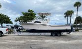
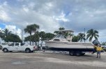
Used my usual boat hauler and put the boat on the trailer in Riviera Beach, FL:

Phil Foster.jpg


Phil Foster 2.jpg


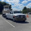
Arrive Clarksville,TN:

Arrive Clarksville.jpg

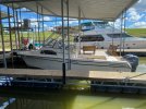
Nestled in at Clarksville Municipal Marina. Good, helpful folks. But will be leaving at sunrise the next morning.

Clarksville Marina.jpgPhil Foster.jpgPhil Foster 2.jpgArrive Clarksville.jpgClarksville Marina.jpg
 
Already screwed up and doubled up on images. I think choosing that "Insert full image" after they were already in thread did it. And I can't figure out how to undo it.

Also, I can probably make the images a tad smaller.

Will try to post tomorrow as we get going to Lake Barkley State Park.
 
I'll enjoy coming along with you as you upload your pics.

Just south of Savannah on the Tennessee River, I found the Shiloh battlefield memorial park to be well-preserved and moving. I had only a couple hours but could have spent the day there and still missed a lot.

If you brought bass fishing gear, you should try both above and below Pickwick Dam. Here are a couple videos fishing at Pickwick in November 2024 and in November 2023.

What I don't know and still wonder is what might be preserved about the Swampers in Muscle Shoals. A museum? The recording studio? If I were on the way to Huntsville I'd have to find out.

Happy cruising.

P.S. If you have the time and inclination, here's the full Muscle Shoals documentary movie.
 
Last edited:
Thanks Iced-D. I hope I can figure out how to post videos as easily as you make it look. I'm catching up with posting after my wife ended her stint with me on this trip. She has accompanied me on short sections of the Loop, but it's not really her thing. So when she is aboard, my priority is that she enjoys the trip and wants to go again.

I didn't get a license for the states (TN, KY & AL) that we went through. But I did sit with some other fisherman while my wife was out on hikes.

So I'll pick up with leaving Clarksville, TN headed for Lake Barkley State Park along the Cumberland River.

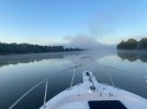
Days were as warm (high 80's) as home in South Florida, but mornings were a bit cooler. So, although we had a 75 mile day ahead, we waited until we thought the fog had mostly lifted.

Early start light fog.jpg


We ran into one heavy fog bank. We were going 'down bound' so I slowed down and stayed just outside the green markers. But not so close to shore that I was likely to bother fishing boats. We put in an AIS radio for this trip and it worked great.

Fog heavier.jpg


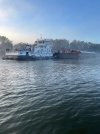
We saw this tug on AIS when two miles away. That's the range I kept it set at. I don't recall why, but he wanted us to pass him on 'two-whistles' or on his starboard side. AIS is so helpful. When you call a tug by name, they almost always answer. And I always thank them for communicating.

Passing tug.jpg


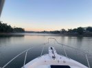
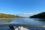
It wasn't long before the fog burned off and we got a gorgeous ride down the Cumberland River.

Gorgeous day.jpg


It was so beautiful the Admiral decided to take the helm for a while!

Admiral.jpg


We'll see if my attempt at inserting a short video via Imgur meets with any success.


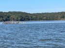
Saw many white pelicans in Lake Barkley (a wider section of the Cumberland River). Every image of them is blurry!

White pelicans.jpg


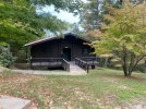
At Lake Barkley State Park. The Restaurant was open, but all the lake front hotel rooms (lodges) connected to it were closed for renovation. We knew that going in. We were happy to have a cabin in the woods. And my wife had access to hiking trails. I don't do well walking very far on hills, unfortunately, and it was about a mile to the restaurant. so the Park would have someone shuttle us so long as we didn't abuse it. They always had trucks running by doing maintenance.


Lk Barkley SP Cabin.jpg

So we stayed in the cabin for a 'rest' day for me and a hiking day for my wife. The Park staff couldn't have been any nicer. I'm going to say that for a lot of parks.

October is the tail end of their 'season', so they didn't have many guests nor boats in the marina. So rather than put us in an uncovered transient slip, they put us in a huge, covered slip. Even after I told them we didn't need 30-amp or water. But it was nice to fiddle on the boat in the shade.

The next day we would have a short run to Moor's Resort. One of our few non-park stops.
 
  • Like
Reactions: Stephnic
I'm amazed - video works. Just need to click sound icon if you want to hear a pair of Yamahas on plane...

I went smaller on the pictures (40%), but looks like I could go smaller still. Or does that just affect resolution and not display size?

A couple of Lake Barkley State Park Marina pics that I intended to include but missed:

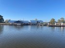
Approach to Lake Barkley marina. The marina is about a mile from the Lodge, so they routinely shuttle gusts between the two. If I remember correctly, 87 octane was the highest grade fuel as was true in Clarksville. This was kind of surprising to me since I thought most engines these days, especially the high performance bass boats that pass me at 50 mph required at least 89 octane, as my 2007 F-250's do.

I know my engines will adjust the spark timing to avoid any pinging, but I believe that is at the loss of a bit of power. In any case, I used Ring-Free+ at each fill up and only took on enough fuel to give me a margin of safety to my next destination when the fuel wasn't 'the good stuff'.

Lk Barkley Marina.jpg

Somewhere among our so many pics, I'll come across a pic of our Grady in its covered slip in Lake Barkley. Not finding it at the moment...
 
Last edited:
The channel in and out of Lake Barkley State Park is several miles long, circuitous and not very intuitive, in my opinion. The advice from the dockmaster as we entered: "don't be afraid to hug the rock walls". Of course, he was exactly right.

I was too focused on not taking out my lower unit to get any pictures on the way in, but with a little more confidence we got some pictures on the way out.

It was a short run to Moors resort and a cooler morning. But we had plenty of time to let the fog burn off. I would need clear sight to find a new route into Moors Resort so as not to repeat my mistake when stopping there while doing the Loop.

The channel lies between the green marker and the shoreline and is deepest very near the shoreline. Picture may not look like it, but we're on plane here, mostly following our track from the way in, but edging a bit closer to the shoreline and finding deeper water.
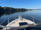
Leaving LB 1.jpg


This was a fairly sharp turn to stay in the deepest part of the channel. Some bass boats whizzed by us. We had no hope of keeping up with them, but we could see where they tended to go. In any case, it's beautiful.
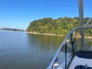
Leaving LB 2.jpg


Even out in Lake Barkley, in many areas, 'the old creek bed' as it is marked on the charts, hugs the shoreline. There is a short cut and you're into Kentucky Lake, a widening of the Tennessee River. We would now be headed 'up-bound' and that is important to know when talking to the tugs and lock masters. There are no compass points on a river system. Say north or south on the radio and someone will scold you.
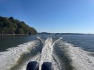
Leaving LB 3.jpg

I believe this is just leaving Lake Barkley Marina, visible in the background.
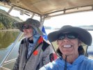
Leaving LB.jpg


So now we're in Kentucky Lake. Most of you probably know that the Tennessee Valley Authority constructed Dams (with locks) and simply flooded out whole towns without dismantling much, if anything in those towns. The main entrance channel channel to Moors is a couple of miles long and skirts one of those towns, visible on the charts. A church with a steeple is very near the channel. Moors has pictures of the exposed steeple during periods of very low water. We were traveling at a time when they were lowering the water in preparation for Spring floods, so we were told. Water was obviously at least several feet lower than it had recently been.

During calm water, Moors channel is well marked with red and green buoys. I guess for some local regulations, these non-federal markers have white tops. The steeple is marked with a white buoy.

When I came through here years ago, the wind was blowing hard out of the west and all I saw was the white top of buoys. Well, I got the wrong white buoys lined up and I nicked the church steeple. Not as bad as I feared and nothing needing repair. But this was shortly after I got my captain's license and boy did I hear about it at home.

Not this time. Garmin's auto routing had us follow a nearshore old river bed that kept us in deep water, near shore, well inshore of the submerged town. My wife still gave me heck about nicking that steeple.
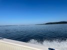

Open Water Lk Barkley.jpg

Again, although we were transient, they offered us a somewhat covered slip. Sure, we'll take it. Unfortunately, I forgot about the VHF antennas, of which there are two. What a horrible sound they made against that low metal frame. The Digital antenna did fine. Another up-and-coming brand antenna from a Miami-based company did not. So continues my luck with pulling into Moors marina.
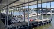
IMG_0307~photo-full.jpg

So what's a resort without an 18-hole golf course? Again, people here were as nice as could be. We had booked a hotel room. But then they closed the restaurant because it got so slow in October. So they offered us a two-bedroom duplex with a full kitchen for $20 more than a hotel room. Worked out great. We had a grocery store's worth of food on the boat. My wife is vegetarian so she is particular about what she packs. We were prepared to spend each night on the boat if need be. Never know when weather delays your carefully planned itinerary. And we didn't know that slips and rooms would be (mostly) easy to get.
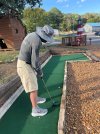
Moors 18-hole golf course.jpg

At Moors, Becky didn't get the same kind of hiking through the woods that she prefers. The surrounding residential neighborhoods had pretty hilly streets, so she did get some workouts in.

Next stop was Paris Landing State Park. And what a stop it was. We didn't have a long run when it was time to leave, But we did have some heavy weather coming in that we wanted to be sure to stay ahead of. Besides, other than fog, I think cruising this time of morning is absolutely beautiful. But that front would change temperatures for the remainder of the trip.

Unfortunately, I had to follow the more normal channel out of Moors to Kentucky Lake, reviving ghosts of Church steeples past. But, when you can see the red and green instead of white tops, the channel wasn't so bad. Besides, I'd already had my one disaster here. My Miami antenna was working, but at a much more limited range. That's why I have completely redundant VHF radios each with AIS.
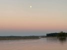
Leaving Moors early am.jpg