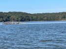
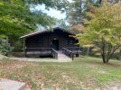
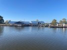
The channel in and out of Lake Barkley State Park is several miles long, circuitous and not very intuitive, in my opinion. The advice from the dockmaster as we entered: "don't be afraid to hug the rock walls". Of course, he was exactly right.
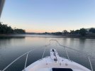
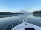
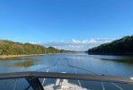
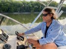
I was too focused on not taking out my lower unit to get any pictures on the way in, but with a little more confidence we got some pictures on the way out.
It was a short run to Moors resort and a cooler morning. But we had plenty of time to let the fog burn off. I would need clear sight to find a new route into Moors Resort so as not to repeat my mistake when stopping there while doing the Loop.
The channel lies between the green marker and the shoreline and is deepest very near the shoreline. Picture may not look like it, but we're on plane here, mostly following our track from the way in, but edging a bit closer to the shoreline and finding deeper water.
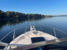
This was a fairly sharp turn to stay in the deepest part of the channel. Some bass boats whizzed by us. We had no hope of keeping up with them, but we could see where they tended to go. In any case, it's beautiful.
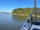
Even out in Lake Barkley, in many areas, 'the old creek bed' as it is marked on the charts, hugs the shoreline. There is a short cut and you're into Kentucky Lake, a widening of the Tennessee River. We would now be headed 'up-bound' and that is important to know when talking to the tugs and lock masters. There are no compass points on a river system. Say north or south on the radio and someone will scold you.
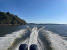
I believe this is just leaving Lake Barkley Marina, visible in the background.
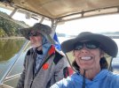
So now we're in Kentucky Lake. Most of you probably know that the Tennessee Valley Authority constructed Dams (with locks) and simply flooded out whole towns without dismantling much, if anything in those towns. The main entrance channel channel to Moors is a couple of miles long and skirts one of those towns, visible on the charts. A church with a steeple is very near the channel. Moors has pictures of the exposed steeple during periods of very low water. We were traveling at a time when they were lowering the water in preparation for Spring floods, so we were told. Water was obviously at least several feet lower than it had recently been.
During calm water, Moors channel is well marked with red and green buoys. I guess for some local regulations, these non-federal markers have white tops. The steeple is marked with a white buoy.
When I came through here years ago, the wind was blowing hard out of the west and all I saw was the white top of buoys. Well, I got the wrong white buoys lined up and I nicked the church steeple. Not as bad as I feared and nothing needing repair. But this was shortly after I got my captain's license and boy did I hear about it at home.
Not this time. Garmin's auto routing had us follow a nearshore old river bed that kept us in deep water, near shore, well inshore of the submerged town. My wife still gave me heck about nicking that steeple.
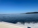
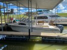
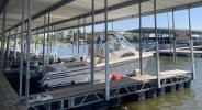
Again, although we were transient, they offered us a somewhat covered slip. Sure, we'll take it. Unfortunately, I forgot about the VHF antennas, of which there are two. What a horrible sound they made against that low metal frame. The Digital antenna did fine. Another up-and-coming brand antenna from a Miami-based company did not. So continues my luck with pulling into Moors marina.
So what's a resort without an 18-hole golf course? Again, people here were as nice as could be. We had booked a hotel room. But then they closed the restaurant because it got so slow in October. So they offered us a two-bedroom duplex with a full kitchen for $20 more than a hotel room. Worked out great. We had a grocery store's worth of food on the boat. My wife is vegetarian so she is particular about what she packs. We were prepared to spend each night on the boat if need be. Never know when weather delays your carefully planned itinerary. And we didn't know that slips and rooms would be (mostly) easy to get.

At Moors, Becky didn't get the same kind of hiking through the woods that she prefers. The surrounding residential neighborhoods had pretty hilly streets, so she did get some workouts in.
Next stop was Paris Landing State Park. And what a stop it was. We didn't have a long run when it was time to leave, But we did have some heavy weather coming in that we wanted to be sure to stay ahead of. Besides, other than fog, I think cruising this time of morning is absolutely beautiful. But that front would change temperatures for the remainder of the trip.
Unfortunately, I had to follow the more normal channel out of Moors to Kentucky Lake, reviving ghosts of Church steeples past. But, when you can see the red and green instead of white tops, the channel wasn't so bad. Besides, I'd already had my one disaster here. My Miami antenna was working, but at a much more limited range. That's why I have completely redundant VHF radios each with AIS.
