Garmin Navionics+ on GPSMAP chartplotters.

Hookup1

GreatGrady Captain
Joined
Oct 16, 2007
Messages
2,602
Reaction score
714
Points
113
Age
69
Location
Cape May, NJ
Model
Islander
Thanks for straightening me out.

You're correct, I bought the Vision upgrade for the first unit.

Interested to hear what you find out.

I've never used Active Captain, perhaps I'll set up the older unit on a battery to update.

What irks me is paying $250 for the card and after a little more than a year it's, while not useless, superseded.

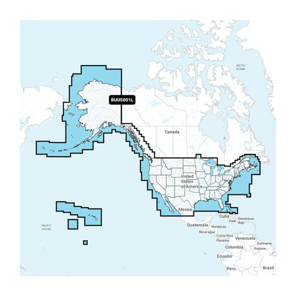
After updating the BlueChart/G3 on the older unit, can the same Navionics in the new unit be installed on the older one if the Vision card is removed?
Recoil Rob could probably do nothing with the charts, add the second unit and everything will work fine. Although I would recommend the software upgrade to v30.10.

The Garmin 86xx series and to a lesser extent the 943/1243 series are older units. But they are multifunction displays and not much is changing. I expect big changes in the sonar technology in the coming years. But charting is charting - the performance is good at this point. Maybe resolution upgrade to 4k displays at some point.
 
Last edited:

Mustang65fbk

Well-Known Member
Joined
Jun 4, 2020
Messages
2,327
Reaction score
629
Points
113
Age
38
Location
Seattle area
Model
Seafarer
I bought a Garmin 943xsv last year as well as their BlueChart G3 Vision chip, I believe it's the VCA018R, but I'm on the west coast near Seattle so it's going to be vastly different than your location. I like it so far, though I don't have the Navionics app and didn't ever use it before. I also don't really have much to compare it to because my other boat the electronics were so old on it that it was pretty laughable at best. I do like the relief shading as well as some of the features of the Vision version like the FishEye3D and a few others. I know that I waited until it went on sale last summer at places like BOE Marine as well as the GPS store, which both had it for about half off. It's normally $350 on the Garmin website but these two stores had it on sale for like $160. I definitely jumped when I saw those prices
 

Hookup1

GreatGrady Captain
Joined
Oct 16, 2007
Messages
2,602
Reaction score
714
Points
113
Age
69
Location
Cape May, NJ
Model
Islander
Chat session with Garmin today.

Frank Kacerek: I have a 8612xsv with Bluechart g3 base maps version 2023.0 and a g3 Vision VUS010R South Florida version 2021.0.

The question is if I am looking at a navigation chart in South Florida which chart will I get? - The 2023.0 version or the 2021.0 version?

I don't really want to update the Vision card.

Kyle: IF the card is in the unit. the map your seeing is from the card.

Kyle: Yes

Frank Kacerek: Looks like ActiveCaptain "installed" the card. So it will pull from the Vision maps if present even though they are older?

Kyle: Yes. Because the built in mapping is different that what the vision is.

Frank Kacerek: Different how? I know it has things that the base map doesn't have like photo's, shaded relief, etc.

Kyle: Just update the vision card. Or get the new Garmin Navionics plus charts


SkunkBoat

Well-Known Member
Joined
Oct 12, 2017
Messages
4,206
Reaction score
1,456
Points
113
Location
Manasquan Inlet NJ
Website
www.youtube.com
Model
Express 265
hahahaha
did you read my experience with Garmin support and my AP?

You know, when they program AI to do Kyle's job the AI will read thru old support chats to find the "best " answer.....
 

Hookup1

GreatGrady Captain
Joined
Oct 16, 2007
Messages
2,602
Reaction score
714
Points
113
Age
69
Location
Cape May, NJ
Model
Islander
It could be AI driven. Any response that sells more Garmin charts is the correct answer. I do get it.

So my last chat with them was how to delete my VUS010-R South Florida charts. To do so I need to pull my ActiveCaptain card, go to maps directory and delete the files. Near as I can tell the base maps in the machine are always there. When you update them a new set is created on the ActiveCaptain SD card. If you plug a map SD card in it will use the maps until you pull the card out. I'm going to set my unit up that way so I have g3 Bluecharts 2023.0 base maps for NJ. And I can plug my old Florida Vision card in for shaded relief.

When I go to Florida in 2024 I may buy a Garmin Navionics Vision+ SD card for South Florida mainly for the updated shaded relief maps and Garmin Navionics charts. If I were deep dropping it would be useful but for my sailfishing the update isn't that useful.

 
Last edited:

Hookup1

GreatGrady Captain
Joined
Oct 16, 2007
Messages
2,602
Reaction score
714
Points
113
Age
69
Location
Cape May, NJ
Model
Islander
Latest chat with the bots had me starting with a new ActiveCaptain card today. Not a big deal. Now the unit has latest software and latest built-in g3 charts. The 2023.0 charts do in fact contain more Navionics info. If the older VUS010R Vision card is plugged in it will get priority over the base maps and loose some Navionics detail. This will allow me to plug it in if I want it and take it out if I don't.

Going forward I will consider a Garmin Navionics Vision+ card for South Florida. I'll handle it the same as the old card - not installed - plug in only. I only want shaded relief charts and the old ones are fine for me.

Not likely going to go with Garmin Navionics+ or Vision+ base maps.
 

Hookup1

GreatGrady Captain
Joined
Oct 16, 2007
Messages
2,602
Reaction score
714
Points
113
Age
69
Location
Cape May, NJ
Model
Islander
Garmin BUS001L U.S. Coastal Canada Built-In Chart Update Garmin Navionics+
On sale $99.99 (normally $149.99) One year subscription.

Gives you the new Navionics look. 10 levels of user selected color depth range shading. Up to 1' contours.
Looks like Garmin is shipping these maps in 86xx and 943/1243 units.

Built-in Maps - GARMIN NAVIONICS+ INLAND & COASTAL​


SkunkBoat

Well-Known Member
Joined
Oct 12, 2017
Messages
4,206
Reaction score
1,456
Points
113
Location
Manasquan Inlet NJ
Website
www.youtube.com
Model
Express 265
Yea I got the e mail sale notice
Screen Shot 2023-03-24 at 9.02.59 PM.png

Does look like I could update FROM existing built-in g3 TO Navionics+ for $99. Have to get on an SD card. Deal is not for Download.

But if I'm gonna spend money might as well get Navionics+ Vision for US East $249. It will work on both of my boats. Unless I move one to Florida....
 

Hookup1

GreatGrady Captain
Joined
Oct 16, 2007
Messages
2,602
Reaction score
714
Points
113
Age
69
Location
Cape May, NJ
Model
Islander
Does look like I could update FROM existing built-in g3 TO Navionics+ for $99. Have to get on an SD card. Deal is not for Download.

But if I'm gonna spend money might as well get Navionics+ Vision for US East $249. It will work on both of my boats. Unless I move one to Florida....
The basemaps are large. When I updated my g3 to 2023.0 I plugged my laptop directly into the router instead of wireless for better speed. Used GarminExpress and created a SD card. Still took a couple of hours.

Hodges has the BUS001L Vision+ card for $90.58. U.S. & Coastal Canada Built-In Chart Updates - Microsd/Sd & 1-Year Subscription
NVUS006R South Florida and Gulf $201.54.
NVUS007R US East $201.54.

The only reason I want the Vision+ card is for the shaded relief charts. I know I want Florida but the old ones are fine for me.

You can get a look at the NJ shaded relief on the Navionics app. See if it gives you anything you don't have.

I'm going to sit tight for now. I don't need to start the subscription clock before January.

7DCF1648-09A3-4AD1-91C5-79D8384BD641.png 730E8238-9AE4-456A-B95A-3942334FCA38.png 9B73E286-D98C-47D7-9083-2CE7E7ACA94C.png 48496471-3506-4C9D-BCFF-BD27690A8FF3.png 9A534EB4-CD7D-4F8B-B917-892EC2E4286B.png 83444A3A-4618-42DC-ADE3-B9B47CD32A66.png 0277907F-1600-4477-8633-03CC0C347AD8.png
 
Last edited:

cap

Member
Joined
May 28, 2019
Messages
20
Reaction score
1
Points
3
Age
71
Location
Savannah, Ga
Model
Tournament 192
Timely thread.
Upgraded from Echomap plus 74cv to Echomap UHD 74SV first of this month.
Read it wrong and thought it included new mapping - coastal and lakes.
Upgraded maps that are on sale are to be delivered today. Hope I got it right this time.
Really wanted the 9 inch just not enough dash on a 192.
 

cap

Member
Joined
May 28, 2019
Messages
20
Reaction score
1
Points
3
Age
71
Location
Savannah, Ga
Model
Tournament 192
Didn't want to lose the little storage at the helm that we have.
Am able to use the storage and also when I'm standing, the box opens and has a brace so the door stands out about 60 degrees and can be seen standing over it.
 

Attachments

  • IMG_5011.JPG
    IMG_5011.JPG
    547 KB · Views: 7
  • IMG_5007.JPG
    IMG_5007.JPG
    318.4 KB · Views: 7
  • Like
Reactions: SkunkBoat

SkunkBoat

Well-Known Member
Joined
Oct 12, 2017
Messages
4,206
Reaction score
1,456
Points
113
Location
Manasquan Inlet NJ
Website
www.youtube.com
Model
Express 265
The basemaps are large. When I updated my g3 to 2023.0 I plugged my laptop directly into the router instead of wireless for better speed. Used GarminExpress and created a SD card. Still took a couple of hours.

Hodges has the BUS001L Vision+ card for $90.58. U.S. & Coastal Canada Built-In Chart Updates - Microsd/Sd & 1-Year Subscription
NVUS006R South Florida and Gulf $201.54.
NVUS007R US East $201.54.

The only reason I want the Vision+ card is for the shaded relief charts. I know I want Florida but the old ones are fine for me.

You can get a look at the NJ shaded relief on the Navionics app. See if it gives you anything you don't have.

I'm going to sit tight for now. I don't need to start the subscription clock before January.

View attachment 28826
Yep Thats Axel Carlson. I fish that exact area alot. The west egde with the ++++++ next to the Polish rocks is a great fluke drift.
I have all the humps marked either from numbers or being on them.

I will probably get the Vision just for being able to see little things off by themselves. Same with Sea Girt reef.

THANKS for the heads up on Hodges price great!

OH! Bass pro has it for $199.99 and I have a $50 gift card from xmas!!!! Ordered NVUS007R US EAST Vision+
 
Last edited:

Hookup1

GreatGrady Captain
Joined
Oct 16, 2007
Messages
2,602
Reaction score
714
Points
113
Age
69
Location
Cape May, NJ
Model
Islander
Yep Thats Axel Carlson. I fish that exact area alot. The west egde with the ++++++ next to the Polish rocks is a great fluke drift.
I have all the humps marked either from numbers or being on them.

I will probably get the Vision just for being able to see little things off by themselves. Same with Sea Girt reef.

THANKS for the heads up on Hodges price great!

OH! Bass pro has it for $199.99 and I have a $50 gift card from xmas!!!! Ordered NVUS007R US EAST Vision+
It may not be a fair comparison to the g3 Bluechart images. Not sure what charts revisions are in my ActiveCaptain. It says 2023.0 but they don't look updated. I'll check my unit Sunday when I'm back South. Either way I think its a worthwhile upgrade.
 
Last edited:

Hookup1

GreatGrady Captain
Joined
Oct 16, 2007
Messages
2,602
Reaction score
714
Points
113
Age
69
Location
Cape May, NJ
Model
Islander
Courious problem on the Navionics app. The markers (their waypoints) don't show with names. The names are retained in the marker and can be opened up to see them. I have not found a setting to change. Not sure if this will carry over to the new Garmin Navionics charts - they are adopting the Navionics user interface. It's not a deal breaker but I prefer to display the names. There are lots of settings like depth shading that are not part of the app so we'll see.
 
Last edited:

Hookup1

GreatGrady Captain
Joined
Oct 16, 2007
Messages
2,602
Reaction score
714
Points
113
Age
69
Location
Cape May, NJ
Model
Islander
On sale thru 3/31/2023. Ordered one. BUS001L Vision+ card for $99.99. U.S. & Coastal Canada Built-In Chart Updates - Microsd/Sd & 1-Year Subscription
 
Last edited:

SkunkBoat

Well-Known Member
Joined
Oct 12, 2017
Messages
4,206
Reaction score
1,456
Points
113
Location
Manasquan Inlet NJ
Website
www.youtube.com
Model
Express 265
So I got the SD card in the Garmin, registered on Active captain, downloaded something....there is a lot of back & forth between Wifi to internet on phone to get stuff in Active captain, then Wifi to Garmin to download from Active captain...

So I see the new stuff on my phone in active captian. After some downloading, I have the extras like Raster Charts, Shaded relief, etc.

On the Garmin the new chart doesnt look much different than g3 but now has Depth shading and Shallow shading in the Navionics style I think. It has Photos.
I can't find Shaded Relief on the Garmin. That is the main reason I wanted the Vision+. Its on Active Captain. Maybe i just need to have the WiFi connected longer.

The Garmin "Fishing Chart" has 1 ft depth lines but you only see them when you zoom in. If you look at your Navionics screenshots vs Active Captain you can see that.

Edit: There are "Chart Settings" in Active Captain. Changing "Chart Size" to small will display the 1 ft lines on Active captain. There are choices for how to display Waypoints.

My Garmin is acting different somehow. Must be part of an update. not quite sure what it is.
 
Last edited:

Hookup1

GreatGrady Captain
Joined
Oct 16, 2007
Messages
2,602
Reaction score
714
Points
113
Age
69
Location
Cape May, NJ
Model
Islander
So I got the SD card in the Garmin, registered on Active captain, downloaded something....there is a lot of back & forth between Wifi to internet on phone to get stuff in Active captain, then Wifi to Garmin to download from Active captain...

So I see the new stuff on my phone in active captian. After some downloading, I have the extras like Raster Charts, Shaded relief, etc.

On the Garmin the new chart doesnt look much different than g3 but now has Depth shading and Shallow shading in the Navionics style I think. It has Photos.
I can't find Shaded Relief on the Garmin. That is the main reason I wanted the Vision+. Its on Active Captain. Maybe i just need to have the WiFi connected longer.

The Garmin "Fishing Chart" has 1 ft depth lines but you only see them when you zoom in. If you look at your Navionics screenshots vs Active Captain you can see that.

Edit: There are "Chart Settings" in Active Captain. Changing "Chart Size" to small will display the 1 ft lines on Active captain. There are choices for how to display Waypoints.

My Garmin is acting different somehow. Must be part of an update. not quite sure what it is.
I have Navionics base maps coming Saturday. I have not used any of the new Navionics charts yet.

Just making sure you ordered a NVUS007R US East. This is the Garmin Navionics Vision+

You may want to go into your Garmin unit and try to install the charts via the Active Captain>Vessel>MyCharts. How did you install the charts? Plug the chip in? That should work too.The chip should show up in ActiveCaptain MyCharts.

With the chip installed you should have at least Nav, Fishing, Raster and Shaded Relief as map display options.

1' depths are part of the Navionics upgrade. I haven't see the new charts yet but I have Navionics app and have a expectation.

Open everything up for max detail. It's flakey and sometimes you have to go in and out to get it to work.

Crazy day tomorrow and Saturday. See how you make out and maybe talk Sunday. The overlay maps are supposed to supersede the base maps. When I upgrade Saturday I have no overlay maps on my machine - just new basemap's.
 
Last edited: